Liptovský Mikuláš · Liptovská Sielnica
Liptovská Mara: History, Flooded Villages and the Little Church
With a volume of 360.5 million m³, Liptovská Mara is the largest reservoir in Slovakia. It was built in 1969 - 1975 as part of the Váh cascade, for flood protection and to generate electricity. Under its waters 13 villages disappeared, 12 completely and Liptovský Trnovec partly, and 940 families had to move, over 4,000 people in total.
Practical information
| Construction | 1969 - 1975 (some sources say work began as early as 1965), filling from 1975 |
|---|---|
| Volume | 360.5 million m³ |
| Area | Almost 27 km² at a water level of 566 m above sea level; the ÚVZ SR bathing water profile gives 21.6 km² |
| Dam | Earth dam with a clay seal, 43.5 m high, structural height 52 m |
| Power station | 198 MW: 2 Kaplan turbines (2 × 50 MW) and 2 reversible Deriaz turbines (2 × 49 MW) |
| Purpose | Flood protection, electricity generation, part of the Váh cascade. Below the dam is the Bešeňová balancing reservoir. |
| Flooded villages | 13 villages, 12 completely and Liptovský Trnovec partly. In all, 940 families, over 4,000 inhabitants, were resettled. |
| Tower of the Church of the Virgin Mary | On the shore near Liptovská Sielnica, below Havránok. An exhibition of the Liptov Museum, viewable from outside only. |
| Mini open-air museum of the flooded villages | Information boards about the 13 villages on the shore in Liptovská Sielnica, by the Koliba Gréta restaurant |
Prices and opening hours change, so check the official website before you go. Official website: Liptovská Mara Reservoir Official website: Tower of the Church of the Virgin Mary, Liptovská Mara
When and why Liptovská Mara was built
The Liptovská Mara dam was built in 1969 - 1975. These are the years given by both Wikipedia and Visit Liptov. Some sources say work began as early as 1965. In 1975 the reservoir began to fill.
The reservoir is named after the village of Liptovská Mara, which disappeared beneath its surface.
Why it was built:
- Flood protection. Visit Liptov gives this as the main purpose of the scheme. The reservoir holds back floodwater on the upper Váh before it can reach the valley further down.
- Electricity. Below the dam there is a hydroelectric power station with 4 turbines and an output of 198 MW.
- The Váh cascade. Liptovská Mara is part of a chain of dams on the Váh river.
- Pumped storage. Below the dam lies the smaller Bešeňová balancing reservoir. When demand for electricity is at its lowest, some of the water from Bešeňová is pumped back up into Liptovská Mara, and at peak times it is used to generate power again.
Liptovská Mara in numbers
| Figure | Value | Source |
|---|---|---|
| Volume | 360.5 million m³, the most in Slovakia | Wikipedia, Visit Liptov |
| Area | almost 27 km² at a water level of 566 m above sea level | Wikipedia |
| Area (bathing water profile) | 21.6 km² | ÚVZ SR |
| Dam | earth dam with a clay seal, 43.5 m high, structural height 52 m | Wikipedia |
| Power station | 198 MW: 2 Kaplan turbines of 50 MW each and 2 Deriaz turbines of 49 MW each | Wikipedia |
| Construction | 1969 - 1975 | Wikipedia, Visit Liptov |
| Flooded villages | 13 (12 completely, Liptovský Trnovec partly) | Visit Liptov |
| People resettled | 940 families, over 4,000 inhabitants | Visit Liptov |
Why two different areas? The size of the reservoir depends on the water level. The figure of almost 27 km² applies when the water is held at 566 m above sea level, in other words when the reservoir is full. At a lower level, the water surface is smaller.
The turbines are of two kinds. The two Kaplan turbines only generate electricity. The two Deriaz turbines are reversible: they can work both as a turbine and as a pump that pushes water from Bešeňová back up.
The flooded villages: what disappeared beneath the water
When the dam was built, 13 villages were flooded. Twelve disappeared completely; Liptovský Trnovec, where our cabin stands today, only partly. In all, 940 families had to move, over 4,000 people.
The Wikipedia list includes these among the villages that disappeared because of Liptovská Mara:
- Liptovská Mara
- Paludza
- Parížovce
- Sokolče
- Čemice
- Ráztoky
- Vrbie
- Demčín
- Nižné Dechtáre and Vyšné Dechtáre
- Liptovská Sielnica (the original village)
Other sources, for example Žiarce, count the thirteen differently and also list Nežitovce, Sestrč and Zadiel. The difference probably comes down to whether a source counts separate villages only or also their parts and hamlets, and whether it counts Dechtáre as one village or two. The number 13, however, appears everywhere.
A village called Liptovská Sielnica still exists today, and the Havránok open-air museum belongs to it. On its shore, by the Koliba Gréta restaurant, there is a mini open-air museum of the flooded villages: information boards with the stories of the people who had to leave their homes.
The Church of the Virgin Mary: the little white church on the shore
The white tower on the west shore can be seen from far away. It is the Renaissance tower of the Church of the Virgin Mary from the flooded village of Liptovská Mara.
What happened to the church:
- Before the reservoir was filled, the Gothic church was taken apart and rebuilt in the Museum of the Liptov Village (Múzeum liptovskej dediny) in Pribylina.
- The tower and the original stone outer walls with the outline of the foundations were left on the shore. They are covered by a replacement roof; the original roof truss is part of the copy of the church in Pribylina.
- The tower is managed by the Liptov Museum in Ružomberok. It houses the exhibition Gothic Heritage of Liptovská Mara (Gotické dedičstvo Liptovskej Mary), which can only be viewed from outside; you can just peek in. It has no opening hours.
There is a snack bar by the little church, and across the road, on a steeper hill, stands Havránok. You can see the church and the hillfort together in two hours.
What you can see when the water is low
The water level of Liptovská Mara varies over the year and drops sharply in dry years. That is when the bottom, normally under water, comes to light.
According to SME Liptov, after one winter with a low water level the old main road re-emerged. It once led from Liptovský Mikuláš through the now flooded villages and on via Vlachy to Ružomberok. The stones of house foundations stuck out of the mud and clay, and in places you could see pieces of the old road.
Do not expect whole houses or churches, though. The most valuable buildings were moved to Pribylina before the reservoir was filled, and mostly the foundations remain of the rest.
If you go out onto the exposed bottom, stick to firm ground. The mud and clay by the water are soft and you can easily sink into them. With children, only go where you can see solid ground.
Pribylina and Havránok: where the history moved to
Liptovská Mara has two close relatives that are worth combining into one trip.
The Museum of the Liptov Village in Pribylina is where the most valuable monuments from the flooded area were moved. There you will see:
- the early Gothic Church of the Virgin Mary from Liptovská Mara,
- the Gothic-Renaissance manor house from Parížovce.
More about visiting in our guide to the Pribylina open-air museum.
The Havránok open-air museum stands on the hill above the little church. When the reservoir was being built, archaeologists surveyed the places that were to be flooded, as well as the hills around them. On Havránok, the research confirmed an Iron Age hillfort with a sanctuary of the Púchov culture. Details, opening hours and admission are in our guide to Havránok.
What to combine it with
You can link the little church, Havránok and the dam by bike; we describe the route in our guide to the Liptovská Mara cycle route. If you want to know where to swim in Mara today, see swimming in Liptovská Mara. More summer tips are on our summer at Liptovská Mara page.
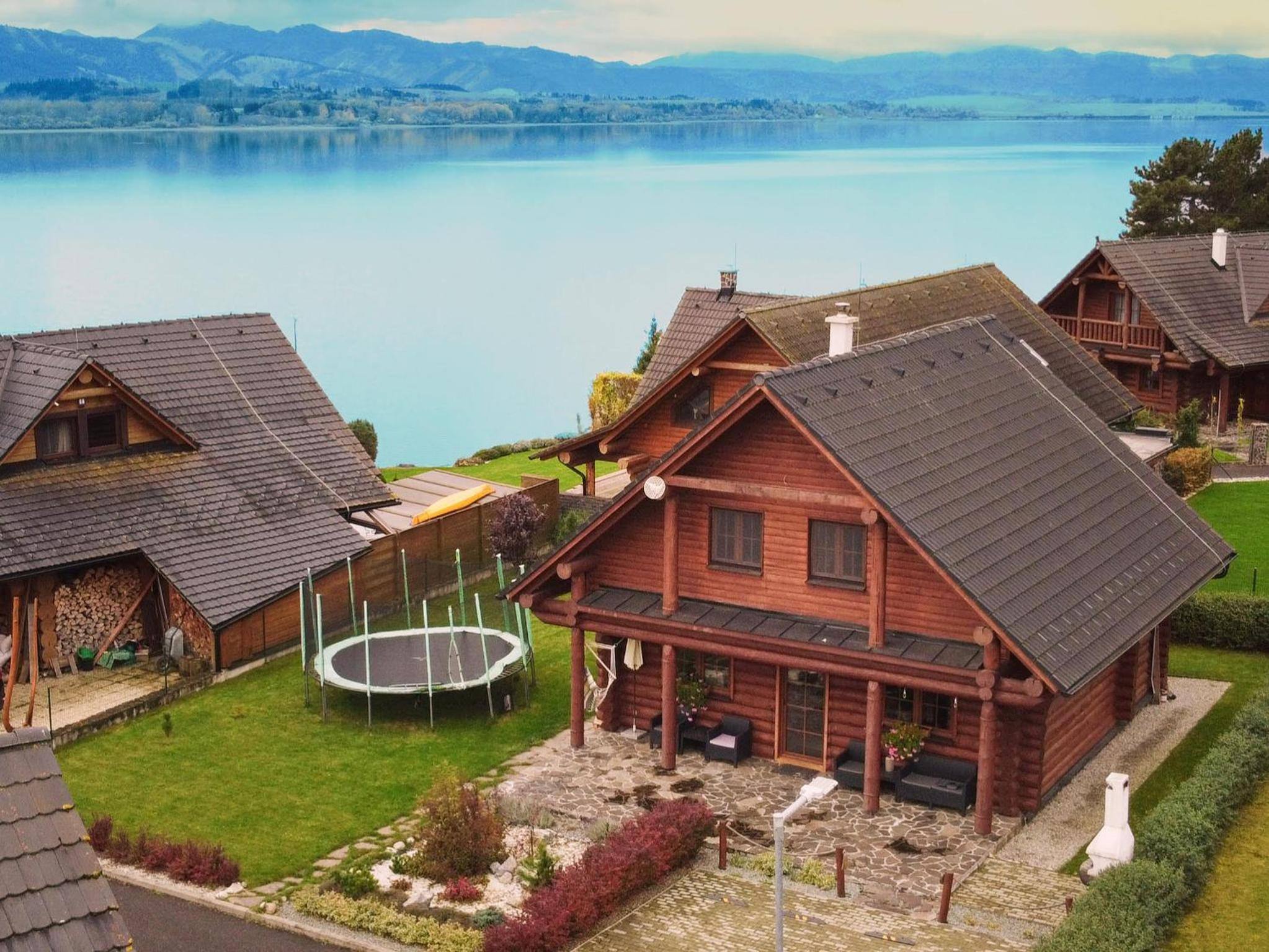
Our log cabin stands on the shore in Liptovský Trnovec, the village that the water flooded only partly. The beach is 50 m from the house. We are a local host and nobody pays us for our recommendations.
Frequently asked questions
When was Liptovská Mara built?
According to Wikipedia and Visit Liptov, the Liptovská Mara dam was built in 1969 - 1975. Some sources say work began as early as 1965. The reservoir began to fill in 1975.
How many villages did Liptovská Mara flood?
According to Visit Liptov, 13 villages: 12 completely and Liptovský Trnovec partly. Those that disappeared under the water include Liptovská Mara, Paludza, Parížovce, Sokolče, Čemice, Ráztoky, Vrbie, Demčín, Dechtáre and the original Liptovská Sielnica; other sources also list Nežitovce, Sestrč and Zadiel. In all, 940 families had to move, over 4,000 people.
How big and how deep is Liptovská Mara?
Liptovská Mara has a volume of 360.5 million m³, which makes it the largest reservoir in Slovakia. At a water level of 566 m above sea level it covers almost 27 km². The earth dam is 43.5 m high.
Why was Liptovská Mara built?
Its main purpose is flood protection on the Váh river. The reservoir is part of the Váh cascade, and the power station below the dam has an output of 198 MW. At times of low demand, two of its four turbines can pump water from the Bešeňová balancing reservoir back into Liptovská Mara.
What is the little white church on Liptovská Mara?
It is the Renaissance tower and outer walls of the Church of the Virgin Mary from the flooded village of Liptovská Mara. Before the reservoir was filled, the Gothic church was taken apart and rebuilt in the Museum of the Liptov Village in Pribylina. The tower on the shore houses an exhibition of the Liptov Museum, which can only be viewed from outside.
Can you see the flooded villages when the water is low?
Partly. When the water level of Liptovská Mara was low after one winter, the old main road from Liptovský Mikuláš through the flooded villages to Vlachy re-emerged, and the stones of house foundations stuck out of the mud. Do not expect whole houses under the water; mostly the foundations remain.
How far is Liptovská Mara from Bosorka Zrub?
Bosorka Zrub stands right on the north shore of Liptovská Mara in Liptovský Trnovec, 50 m from the beach. To Havránok and the little church below it, it is 13 km, about 20 minutes by car.
Sources
- Wikipedia: Liptovská Mara (dam)
- Wikipedia: Bešeňová (reservoir)
- Visit Liptov: Liptovská Mara, facts about its construction, history and flooded villages
- Visit Liptov: Mini open-air museum of flooded villages
- Wikipedia: List of defunct villages in Slovakia
- Žiarce: Tower of the Church of the Virgin Mary, Liptovská Mara
- ÚVZ SR: Liptovská Mara, bathing water profile (PDF)
- SME Liptov: Liptovská Mara revealed the foundations of flooded houses
- Vtedy.sk: 1975, the Liptovská Mara reservoir begins to fill
How we put this together
We checked prices, opening hours and rules on the operators’ official websites (01/10/2026). Driving distances and times are approximate (OpenStreetMap), measured from the Bosorka Zrub log cabin in Liptovský Trnovec. We are a local accommodation provider and nobody pays us for recommendations.